On August 18, 1926, something remarkable happened — and almost nobody noticed. A simple sheet covered in pale blue-green lines quietly ushered in a new era. It wasn't dramatic or designed for public consumption, but it represented a groundbreaking moment: the very first weather map transmitted by radio, sent from Arlington, Virginia, to the U.S. Weather Bureau in Washington, D.C..
A Technological Leap
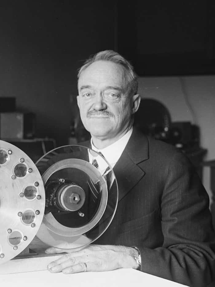
Behind this achievement was C. Francis Jenkins, an early television pioneer who had already been tinkering with sending pictures over radio waves. When the Weather Bureau posed a compelling question — could his technology handle weather maps, not just photographs? — Jenkins set out to prove it could. What followed was an experiment destined to reshape how forecasting worked.
The method, remarkably clever for its era, went like this:
- Black ink on thin white paper was used to draw the day's weather map.
- A photographic negative was produced, rendering the map's lines as transparent areas.
- At the Navy's Arlington radio station (Station NAA), this negative was wrapped around a glass cylinder that rotated steadily.
- A focused pinpoint of light passed through each transparent line as the cylinder turned, striking a photoelectric cell that translated the light into electrical pulses.
- At a receiving station, those pulses controlled a pen mounted on its own spinning cylinder, painstakingly rebuilding the map one line at a time.
The whole transmission process took about fifty minutes. What emerged on the other end was rough around the edges but perfectly readable — a functional weather map that arrived without the need for couriers or cables.
The Role of the U.S. Navy
The Navy's involvement went well beyond simply providing a transmitter — it actively pushed the system's boundaries. Vessels including the U.S.S. Kittery and U.S.S. Trenton successfully picked up these transmitted maps from as far away as Guantanamo Bay, Cuba, sometimes even when thunderstorms crackled through the atmosphere. These trials demonstrated something powerful: weather data could cover enormous distances at speed, offering tremendous potential for both shipping and aviation.
Now, while we might loosely describe this as "televised" since images were being transmitted, let's be clear — there was no camera involved, no on-screen presenter, and certainly no audience watching from home. The sole recipient was the Weather Bureau. Public weather broadcasts on actual television screens were still decades in the future.
Consider that in Britain, the Met Office had been producing forecasts since 1861, yet a TV weather segment featuring an on-screen forecaster didn't debut until 1954. Across the Atlantic, NBC's Today show delivered its first televised weather forecast on January 14, 1952, this time with a real presenter in front of the camera.
Why It Mattered
What made the 1926 broadcast so significant went far beyond simple convenience. Prior to this, weather maps traveled by mail or telegraph — methods often too sluggish to be genuinely useful when conditions were changing rapidly. By shrinking delivery time to under an hour, the Jenkins method cracked open the door to something approaching real-time forecasting. For vessels navigating open seas and personnel at remote stations, that kind of speed could spell the difference between safety and peril.
In the end, Jenkins's radio weather map amounted to a quiet revolution — a proof of concept showing that visual information could be shared across the airwaves. Faster and sharper technologies eventually took its place, but the core principle it demonstrated — that weather information needs to move as swiftly as weather itself — continues to drive forecasting innovation to this day.
From that beam of light piercing a spinning glass cylinder to the animated radar maps glowing on your smartphone, there's a direct through-line stretching back to a summer morning in 1926, when the atmosphere's hidden patterns first began traveling at the speed of radio.