Before a hurricane earns its fearsome reputation, it starts life as something far less dramatic — a tropical depression. These low-atmosphere disturbances feature thunderstorm clouds rotating counter-clockwise around a "low-pressure" zone, with wind speeds building steadily. The moment those winds hit 39 mph or higher, the system graduates to a named storm. When the National Weather Service initially detected what would become this particular tropical depression forming in the Bahamas, Florida immediately braced for impact. By August 25, 2005, Katrina had intensified into a category 1 hurricane, cutting across Florida's southern tip before charting a northwest course into the Gulf of Mexico.
The world held its collective breath as Katrina crept steadily toward the Gulf Coast, with Alabama and Louisiana squarely in the crosshairs. Over the following days, the storm drew energy from warm waters as it bore down on New Orleans, ultimately strengthening into a category 3 monster packing maximum sustained winds between 111 and 129 mph. Residents along the Gulf Coast shifted into high alert, and the entire region dissolved into a patchwork of warnings and evacuation orders. Somewhere between 25,000 and 30,000 people sought refuge inside the Superdome, while countless others ignored evacuation directives altogether, instead scrambling onto rooftops and bridges as floodwaters surged around them.
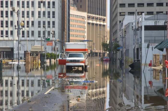
At 6:10 a.m. on August 29, 2005, Katrina slammed ashore for the second time. During the overnight hours beforehand, the hurricane's maximum sustained winds had surged to category 5 intensity — 157 mph or higher. Though the storm lost some power as it collided with the Gulf Coast, its epicenter struck just east of New Orleans, triggering catastrophic levee failures that sent water pouring into the city. Katrina would go down as the costliest hurricane in United States history, leaving behind an estimated $161 billion in property damage and a heartbreaking death toll of 1,833 lives lost.